CO2 Continues Dangerous Rise, Hits 400.2 Parts Per Million in Late February

mlo_one_week

(Daily and hourly CO2 readings at the Mauna Loa Observatory from February 20 to 26. Image source: The Keeling Curve.)

More than two months before typical annual maximum in late May or early June, global average CO2 levels have again breached the dangerous 400 part per million threshold.

On February 26th, Mauna Loa’s CO2 observatory recorded three hourly readings at or above 400 parts per million with a peak value of 400.2 ppm. The reading comes just ten months after weekly CO2 values exceeded 400 parts per million during May of 2013, the first time in more than 3 million years that atmospheric levels have been so high.

At the current annual rate of increase, we can expect CO2 levels to peak around 401.5 to 403 parts per million sometime in late May of this year. Last year’s average annual rate of increase was 2.6 parts per million over 2012. If 2014 were to match this, abnormally rapid, pace, daily and hourly measures could exceed peak values of 403 parts per million over the next two months.

A Steepening Rise of Concentration

From the early 1960s the pace of atmospheric CO2 increase was about 1 part per million each year. As human population, fossil fuel consumption, and industrialized agriculture expanded, annual rates of CO2 increase up-ticked to about 1.5 parts per million from 1980 to 2000 and again to slightly above 2 parts per million each year from 2000 to the present. Due to a number of factors including an expected continued increase in fossil fuel burning, the exhaustion of various carbon sinks around the globe, expected changes to ocean and land based photosynthetic life, and the release of various global carbon stores due to amplifying feedbacks related to human-caused warming, rates of CO2 increase are expected to be as much as 7 parts per million or more each year by the middle of this century.

co2_800k_zoom

(An ever-steepening curve. CO2 levels from 1700 to the present. Image source: The Keeling Curve.)

Current Pace of Emission Without Precedent

The current pace of emission has no corollary in the geological record. Based on best observations, the fastest CO2 increases in the past were during either the PETM extinction event of 55 million years ago or the Permian Extinction, or Great Dying, of 250 million years ago. During these periods, rapid rates of CO2 increase were observed at about .35 parts per million each year. The current pace is now six or seven times that seen during these dangerous geological epochs and expected rates of CO2 increase during this century could exceed 20 times that seen in the record.

It is worth noting that more than 32 billion tons of CO2 now go into the atmosphere each year and that this rate of emission alone is about 160 times that of volcanic emissions the world over. Total human carbon emissions in CO2 equivalence for all greenhouse gasses is now over 50 billion tons, or more than 200 times global volcanic emissions. Even an epic flood basalt on the order of that which appeared during the Permian Extinction couldn’t match the current pace of human emission.

CO2 emissions sks

(CO2 emissions through 2012 with related IPCC scenarios overlaid. Image source: The Conversation.)

The very rapid pace of increase also drives an exceedingly rapid pace of climate and geophysical change. Among the impacts include very rapidly rising temperatures, potentially very rapid ice melt and global sea level rise, potentially very rapid pace of ocean stratification and anoxia, rapid and chaotic reordering of climate and ecological zones, and a pace of ocean acidification that has no corollary during any past geological age. This combination of rapid-fire impacts presents very severe hazards to all life and ecological systems that are likely to result in stresses never before seen on Earth over the next century under business as usual fossil fuel emissions.

What Does the World Look Like at 400 Parts Per Million CO2, Long-Term?

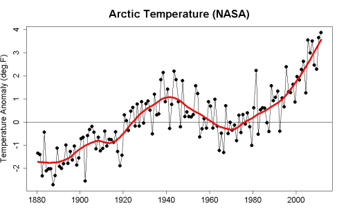
Considering that we are already passing the dangerous 400 ppm CO2 threshold, it is important to think about what a world with a near constant level of CO2 in this range looks like over the long haul. This is important because, in the current political climate, it appears highly unlikely that fossil fuel emissions will ever be brought into a range that results in a potential for atmospheric CO2 decline (approaching zero fossil fuel emissions). In addition, a number of heat-driven amplifying feedbacks are already in place that are pushing some of Earth’s large carbon stores to release. These include, but are not limited to, major Arctic carbon store releases and major tropical forest carbon store releases that are now likely on the order of human CO2 emissions during the middle of the 20th Century.

In addition, the human and feedback methane release, human nitrous oxide release, and other human greenhouse gas release counters all the global cooling resulting from human aerosol release (sulfur dioxide etc). And while the human aerosol release will eventually draw down with the cessation of coal use (either through laissez faire depletion or through an attempt at rational political action), these other greenhouse gasses will remain in the atmosphere for years, decades and centuries.

The result of these combined factors is that the world is likely to remain in the range of 390-405 parts per million CO2 even if rapid mitigation were to begin today. And so it is worthwhile to think about what such a world looks like, considering that to be our rational, best case scenario, and not to put too much faith in the entirely too conservative equilibrium-based scenarios posed by the IPCC.

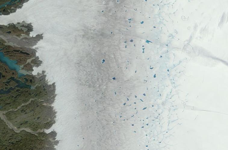
For a corollary to our absolute best case, we should therefore look to the Pliocene climate of 3.0 to 3.3 million years ago when CO2 levels stabilized at around the current range of 390 to 405 ppm CO2. And Pliocene during this time was 2 to 3 degrees warmer than the 1880s average. It was a climate in which sea levels were at least 15 to 75 feet higher than today (some studies show up to 110 feet higher). And it was a climate in which the Greenland and West Antarctica were entirely bereft of glaciers.

This climate vision of the past if probably the absolute best we can hope for under current systems and a very rapid mitigation. Wait just a few more years and we push above the 405 parts per million threshold as we begin entering a rough corollary to the Miocene climate of 15 million years ago. Wait another few decades and we get to the 500-600 part per million threshold that puts all ice on Earth at risk of melt and sets in place conditions, according to paleoclimate, where a 4-6 C temperature increase is locked in.

Rapidly Moving Into an Ever More Dangerous Future

WD_tarsands_emissions

(Alberta Tar Sands. Just one major unconventional fuels project rapidly pushing the world toward climate change game over. Image source: Water Defense.)

That the current pace of change in unprecedented is probably an understatement. Human beings and governments need to come to grips with the ever-more-dangerous world they are creating for themselves, their children and grandchildren. Focus should now be put on preventing as much harm as possible. And all government action should be aimed at that result.

There is no greater threat presented by another nation or set of circumstances that supersedes what we are now brazenly doing to our environment and the Earth System as a whole. And the rate at which we are causing the end level of damage to increase is practically unthinkable. Each further year of inaction pushes us deeper into that dangerous future.

Links:

The Keeling Curve

Tropics Found to Release Two Gigatons of Carbon Each Year

Arctic Sea Ice Melt, Methane Release Shows Amplifying Feedbacks to Human Caused Climate Change

What Does a World at 400 Parts Per Million CO2 Look Like Long Term?

The Emissions Gap Report

The Conversation

Water Defense

The Storms of Arctic Warming: Polar Amplification, Vortex Disruption to Set off Extreme Weather Events For US, UK Yet Again

It’s happening again.

A story that starts in the Arctic where abnormally warm temperatures for this time of year are in the process of disrupting the polar vortex, shoving its node out of the Arctic Ocean and pushing it all the way south over Hudson and Baffin Bay. The result is a core of extreme cold shoved much closer to related warmer, southerly regions. A highly unstable event that is likely to spawn extreme weather for the US and UK yet again.

This polar heat amplification and related extreme weather is a signature of human-caused global warming. And though it wears a grotesque mask of what some would call a normal Arctic oscillation, it is anything but.

Our rapid production of greenhouse gasses since 1880 has caused the Arctic to warm, on average, by about 5.3 F (3.0 C). This rapid increase in warming is nearly 4 times that of the global average and resulted in temperatures for the Arctic, during the 20th Century, reaching a range not seen in at least 44,000 years and likely 120,000 years. Since warming has continued well into the first and second decades of the 21rst Century, Arctic temperature excursions are likely outside even that extreme range and may well now be approaching averages when parts of today’s Arctic first began to freeze and glaciate.

NASA Arctic Heat Amplification

(Arctic temperature increase from 1880 to 2012. Image source: Tamino. Data source: NASA GISS.)

The causes of this rapid Arctic amplification are manifold. First, human greenhouse gas emissions added more heat to the oceans and atmosphere. The polar sea ice, sitting atop a warming ocean went though a period of recession from the 1920s through the 1950s, hovered in about the same zone during the 60s and 70s and then commenced a more rapid melt phase from the 1980s onward.

Loss of Sea Ice and a Changing Jet Stream

Loss of sea ice reduced northern polar albedo (reflectivity) by a total of 4% since 1980 which increased Arctic heat capture by an amazing 6.4 watts per meter squared (more than 4 times that of human CO2 forcing over the entire globe). As a result, the seas under the Arctic ice cap began to even more rapidly warm. By 2012 the warming was intense enough to have reduced end-summer sea ice volume by 80 percent since 1979. Now, during winter time, a perforated and much diminished sheet of sea ice bleeds ocean heat into the Arctic atmosphere. As a result, cold air tends to be shoved out of the Arctic Ocean basin more and more often.

piomas-trnd2

(Sea ice volume losses with exponential trend. Image source: Wipneus. Data Source: PIOMAS.)

This bleeding of oceanic heat has bent the Jet Stream ever northward over two zones — one over Svalbard and one over Alaska. And both these Jet Stream weaknesses allow warmer air to rush into the Arctic from the south. These various heat forcings cause the winter time polar vortex to wobble uneasily over a warming Arctic Ocean even as it is more frequently ripped apart by warm air incursions through the oceanic weak points. Meanwhile, these vortex disruption and collapse events spill cold air southward over the continents and into the Atlantic Ocean.

Yet one more Polar Vortex Disruption

And for this winter, such Arctic heat driven polar vortex disruption and collapse events have been the norm. This week is featuring yet one more — sparking extreme weather that will revisit both the US and UK over the coming days.

T2_anom_satellite1

(Climate Change Institute Map Showing Arctic Heat Anomaly 2.68 C above the, already warmer than normal, 1979 to 2000 average. Image source: Climate Reanalyzer.)

Today, the Arctic temperature anomaly was 2.68 degrees Celsius above the, already warmer than normal, 1979 to 2000 average. Areas near Svalbard, Alaska, and Baffin Bay showed extraordinary temperature departures in the range of 15 to 20 degrees Celsius above average. Meanwhile a zone of cold, Arctic air has been shoved southward over the US, setting up extreme temperature differentials over a relatively small area and putting in place conditions ripe for extreme weather.

A Tale of Three Storms

A large Pacific storm now in the process of leaping over the west coast blocking pattern is forecast to dump up to 5 inches of rain on a parched California before injecting itself into the highly unstable atmosphere over the central and eastern US. Areas in the center of the US such as Oklahoma may experience a range of weather from thunderstorms to tornadoes and precipitation running the gambit between snow, hail, ice, and rain. This system is predicted to spread out, covering a massive swath from Texas to Maine and incorporating at least two low pressure systems. It will draw in a deep flow of warmth and moisture from the Gulf of Mexico and this warm and moisture laden air will abruptly collide with the much colder Arctic air to the north. Extreme rain, ice and snowfall are certainly possible as this intense event is expected to last from Saturday through Monday.

Across the Atlantic, as the Jet Stream invades southward and picks up speed, a gale formed to the south of Greenland and Iceland before barreling on into the storm ravaged shores of England and France. The gales and storms this winter for the region have been relentless, resulting in the stormiest winter ever on record for England and creating conditions so battering and exhausting that more than 21,000 sea birds are thought to have tragically lost their lives in at sea before washing up on French shores.

Now a strong double barrel low pressure system is bringing gale force winds and heavy rains back to a United Kingdom that has suffered an almost constant assault of storms since the middle of December. Flood warnings have again been issued for multiple counties and regions just north of London, which experienced 60 degree temperatures earlier this week, are expected to see snow. The storm is expected to sweep through the UK on Friday and Saturday before exiting Sunday. A storm of similar intensity is then expected to return to the UK on Monday where the process of gales and floods are likely to again repeat.

Sediment outflow England France Storms

(Sediment outflow from the swollen rivers of England and France on January 26 as yet another storm encroaches. Image source: Lance-Modis.)

In total, this worst continuous period of storms in UK history, has resulted in over a billion dollars in damages. Meanwhile, the storms are expected to continue through at least early March.

Overall, these extraordinary conditions cannot be entirely separated from the still-high temperature deviations occurring in the Arctic. Usually, by this time of year, the ice is solid enough and the warm air incursions are weak enough to allow at least some minor re-establishment of the polar vortex. Not so for 2014. The above average temperatures throughout the Arctic continue and show little sign of abatement as we head into March and the end of sea ice freeze season.

Links:

NOAA’s Ocean Prediction Center

Winter Storm Encroaches

NASA Lance-Modis

PIOMAS

The Climate Change Institute

NASA GISS

Arctic Hotter Than at Any Time in at Least 44,000 Years

Polar Albedo Loss Due to Ice Melt Twice that Predicted by Models

Hat Tip to Colorado Bob

Tamino

Wipneus

21,000 Sea Birds Lost Due to Extreme North Atlantic Storms

With Glaciers Undergoing Collapse, Sea Level Rise to Flood More Than 1,500 of Indonesia’s Islands, Capital City Over Next 50 Years

Indonesia_BMNG

(Satellite rendering of the vulnerable Indonesia Archipelago — a system composing 17,000 islands. Image source: Commons)

From a climate-wrecking human warming spurring the melting of glaciers and ice sheets to the thermal expansion of the world’s oceans, sea level rise, to some degree or another over the next century is a given. How rapid this expansion progresses and how much land it devours will ultimately depend upon the amount of heat trapping gas we belch into the atmosphere and how sensitive the Earth’s climate system is to our increasingly traumatic insults.

Current conservative assessments from the Intergovernmental Panel on Climate Change (IPCC) estimate a total of 90 centimeters (nearly 1 meter) additional sea level rise before the end of this century. Today’s rate of sea level rise gets us to about 30 centimeters over the same period, so the IPCC is projecting that the pace of rising seas will more than triple over the coming years and decades.

Sea level rise 1993 to 2014

(Global Sea Level Rise from 1993 to 2014. Image source: AVISO.)

Despite the fact that the rate of sea level rise and related glacial melt would have to rapidly uptick to meet the IPCC estimate, it remains a conservative case. Temperatures, over the next century under business as usual fossil fuel emissions or a moderate mitigation scenario, are likely to increase by between 5 and 9 degrees Celsius. This range of global heating is enough to eventually melt all or nearly all the glacial ice on Earth. So the heat forcing to the world’s glaciers is expected to be extreme, a blow at least equaling the temperature change between now and the last ice age. A temperature change that took 10,000 years to complete now crammed into an exceptionally brief period from 1880 to 2100.

Under such an outrageous pace of warming, a warming that could propel Earth to near Permian and PETM temperatures within 85 years, it is likely that the rate of sea level rise could be double or more that of IPCC predictions, possibly equaling or exceeding peak rates of sea level rise during the end of the last ice age at 10 feet per century. So the range of increase may well be between 1 and 3+ meters, making the IPCC case quite an underestimation if business as usual fossil fuel emissions continue.

survey_histogram1

(Survey of scientist projections of sea level rise in centimeters by 2100 under a high emissions scenario (RCP 8.5). Note that a majority of scientists project sea level rise in the range of 1 to 3 meters by 2100 with some scientists projecting as much as a 3 to 6 meter rise over the same period. Image source: Real Climate’s Excellent November Report on Sea Level Rise)

Stresses to glacial systems are already extreme even at the current human forcing of 400 ppm CO2, 1835 ppb methane, and at rising levels of a host of other greenhouse gasses. Current CO2 levels alone, during the Pliocene, were enough to establish seas as much as 75 feet higher than today. A fact that raises the question — if we already have 15-75 feet of sea level rise locked in, how swiftly will that rise occur? And the answer to that question depends on how rapidly the world’s largest glacial and ice sheet systems respond to human greenhouse gas forcing.

Very Large Glaciers Already on the Move

In a recent study one of the world’s largest ice sheets, the Pine Island Glacier, was found to be undergoing the first stages of an irreversible collapse. In other words, over the coming decades, the Pine Island Glacier (PIG) is due to complete an unstoppable slide into the Southern Ocean. And loss of the Pine Island Glacier alone commits the world to about 1 meter of additional sea level rise.

Unfortunately PIG is the first of many glacial systems from West Antarctica to Greenland that are likely to suffer the same fate. For from these vulnerable regions, mass losses from glacial melt have more than doubled over the past decade. In total, by 2008, about 90% of the world’s glaciers were in retreat. And since that time, warming has continued to advance with melt episodes becoming ever-more predominant.

Greenland melt lakes, dark snow, August 4, 2013.

Melt lakes, many larger than 5 kilometers across, form over Western Greenland, August 4, 2013. Summer of 2012 saw Greenland mass loss hit 600 cubic kilometers. Image source: Lance-Modis.

Greenland, for example, has exhibited increasingly severe melt stress over past summers with large stretches of lakes, many measuring 5-10 kilometers wide, forming over an ever-less-stable ice sheet. A towering ice sheet that boasts an average altitude of two kilometers, Greenland’s vast glacial system contains an immense volume of frozen water. But as great and mighty as this mountainous pile of ice may seem, human caused warming continues to deliver a series of ever-more damaging blows. By 2012  Greenland had experienced a record wasting with 97 percent of its surface area showing melt during July and over 600 cubic kilometers of ice lost throughout the entire year. Yet as warmth continues to advance poleward, the 2012 melt season is likely to seem tame with far greater annual losses in store.

So there are many reasons to believe the IPCC estimates for glacial melt rates and related sea level rise, as with Northern Hemisphere sea ice losses, are too conservative and that science, in general, is still coming to grips with a dramatic and geologically unprecedented pace of change. That said, even IPCC findings are becoming increasingly stark.

Indonesia to Lose 10% of its Islands by Mid-Century

For if only the very conservative IPCC estimates bear out, we are still likely to see dramatic loss of lands and displacement of human beings.

A glaring example appears in new report from Maplecroft’s Climate Change Vulnerability Index which found that more than 1,500 islands in Indonesia would disappear after just a half meter of sea level rise. The study also found that the same amount of sea level rise would flood up to half of the capital city of Jakarta. Meanwhile, the 90 centimeters of sea level rise projected by the IPCC for the end of this century would put 42 million people along the coastline at risk of losing their homes.

Ancha Srinivasan, principal climate change specialist with the Asian Development Bank (ADB) noted in an interview that:

This archipelago’s biggest threat is rising sea levels, where 42 million people living three kilometres from the coast are vulnerable if estimated sea level rise reaches up to 90 centimetres by the end of the century.

Indonesia is composed of over 17,000 islands, many of which are low lying or feature sprawling and vulnerable coast lines. It is located in a region of the world where ocean levels are among the most rapidly rising. It is among a growing number of islands and low-lying coastal regions that are under increasing threat from what would seem even a modest change in sea level.

But as we went at length to illustrate above, Indonesia and other regions may be lucky to see only a 90 centimeter rise. So these projected impacts, though seemingly stark, may be at the low end of what we are likely to experience. Add just one more meter and most of Jakarta is flooded while 42 million of Indonesia’s people are almost certain to be members of a vast global migration away from the world’s coastlines.

Links:

Indonesia Risks Losing 1,500 Islands by 2050

Indonesia: Rising Seas Threaten 1,500 Islands

Maplecroft’s Climate Change Vulnerability Index

AVISO

Real Climate’s Excellent November Report on Sea Level Rise

What does a World at 400 PPM CO2 Look Like?

Pine Island Glacier Undergoing Irreversible Collapse

The Pine Island Glacier

SkS Report on Glacier Retreat

The Greenland Ice Sheet

Greenland Experiences 97 Percent Surface Melt in July of 2012

Dr Jennifer Francis and the Year-Long Blocking Pattern

Last year, on March 30th, I wrote this:

Over the past decade, an increased prominence of blocking patterns has emerged. These events happen when the polar jet stream gets stuck in large meanders. These meanders result in a long persistence of weather for regions affected by these blocking patterns. New papers by Jennifer Francis and other polar researchers last year linked the increasing occurrence of these new blocking patterns to an erosion of Arctic sea ice…

Low pressure systems keep forming over the Bering and Okhotsk seas. Warmer air temps keep invading the American and Canadian west. The eastern part of the North American continent sees a continuous colder air invasion from the Arctic. The Arctic remains much warmer than average…

I may have well written the same thing today. For the weather pattern is mostly unaltered.

Blocking Pattern February 24

(High amplitude blocking pattern plainly visible over the US and Canadian West along with associated trough over the Central and Eastern US in the February 24 Jet Stream model. Image source: University of Washington.)

In fact, if anything, this winter only saw its intensification with numerous polar vortex disruption events, a vicious Arctic heat anomaly that featured and Alaskan thaw in January and Sea Ice setting new record lows for the month of February, and an extraordinary western drought leading to a collapse in California farming and a 10-15 percent hike in prices at US grocery stores.

For a blocking pattern to have persisted for such a long time is somewhat unprecedented. According to the standard definition of blocks (what I’m referring to as blocking patterns) the systems generally tend to last for days or weeks. The most powerful of blocks, like the Bermuda High, tend to last, at most, for a season. But this West Coast and Pacific block has now remained in place for nearly a year. A more solid validation of Dr. Jennifer Francis’ hypothesis — that sea ice melt can result in large Jet Stream meanders and ‘stuck’ weather patterns — is difficult to find.

Dr. Francis, writing for Yale 360 in 2012 queried:

Does it seem as though your weather has become increasingly “stuck” lately? Day after day of cold, rain, heat, or blue skies may not be a figment of your imagination. While various oceanic and atmospheric patterns such as El Niño, La Niña, and the North Atlantic Oscillation have been blamed for the spate of unusual weather recently, there’s now a new culprit in the wind: Arctic amplification. Directly related to sea-ice loss and earlier snowmelt in the Far North, it is affecting the jet stream around the Northern Hemisphere, with potentially far-reaching effects on the weather.

If we were to look for further validation, we might point to a period of storminess of epic intensity that re-shaped England’s coastline, tossed multi-ton boulders about as if they were toys, wrecked rail lines, and dumped so much rain over the English countryside that aquifers began erupting from out of the ground. Since mid December England has suffered its most intense and extended period of stormy weather ever on record. An ongoing disaster that has caused the government to re-consider all its previous assumptions about storm preparedness and should be causing it to reconsider its fossil fuel use as well.

UK House surrounded by floods

(UK home surrounded by floods. Image source: WTOP.)

For if anyone would say their weather seemed stuck, it would probably be the, still soggy, British. And perhaps those brave souls will provide some validation for Francis’ hypothesis and the predictive power it contains for any who dare to wield it.

Earlier this winter, noting that the shape of the Jet Stream hadn’t changed much since early 2013 and that the Pacific block still remained in place, I penned an article entitled: Winter 2013-2014 — Sea Ice Loss Locks Jet Stream into Severe Winter Storm Pattern for Much of US. The article still receives a remarkable flow of traffic, probably due to the fact that is was predictive of a set of conditions that are ongoing now, 70 days after it was written. And to whom do I owe the ability to generate such an insight? Why the author of the theory herself — Dr. Jennifer Francis.

Simply put, she predicted the weather would probably be extreme and that it would probably end up stuck. And so it has for at least three years running now. Don’t believe me? Just look at the US over the past three years. 2012 featured a drought that drove Mississippi river traffic into mud banks and wrecked a huge swath of the US corn crop before giving way to major flooding and heavy precipitation events that lasted long into 2013. The drought retreated westward where, by 2014, a ravaged California cut off all water to farmers. Meanwhile, the Eastern and Central US suffers a string of weather extremes that include swings in temperature of greater than fifty degrees over the course of just a few days, major winter storm events, flash melts, followed by flash freezes and tornadoes over snow.

Dr. Kenneth E. Kunkel, research professor for NOAA’s National Climate Data Center observed that the occurrence of extreme weather events for the US Midwest had increased by 40 percent over the past 20 years stating:

The number of extreme precipitation events in the Midwest has been increasing over the last 20 years, which is consistent with what we would expect from climate change, which has caused increased amounts of water vapor in the atmosphere. While the heavy snow of this winter is primarily a consequence of the persistent storm track, it may have been enhanced by the increasing amounts of water vapor in the atmosphere.

And this leads us nicely back to how climate change is currently wrecking the world’s weather — by weakening the Jet Stream and by amplifying the hydrological cycle. Both instances we have seen in glaring relief over the past few years of very extreme weather. Dr. Francis, in her own research found that Jet Stream winds over the US had weakened by as much as 20% during the period of 1948 to 2010. A significant reduction in its own right:

francis_amplification

(Slowing of 500 mb winds from 1948 to 2010. Image source: Weather Underground.)

I bring up these instances and proofs to show, at least in the context of currently ongoing weather, that Dr. Francis’ claims have born out. Some scientists disagree, however, and appear to be using their clout to shut down what is now a useful tool for extreme weather prediction. And this is a sad event, because the climate state in which Dr. Francis’ predictions hold true probably won’t last for more than a few decades. The weather will certainly remain extreme. But by the time polar amplification has pushed the ice sheets to swiftly melt and human warming has pushed the tropics into a phase of rapid heating, the Jet Stream is likely to again intensify even as it re-centers around Greenland and the North Atlantic. Such changes will probably bring an entirely different set of weather concerns.

But, for now, as the northern polar region amplifies, Dr. Francis’ predictions bear out remarkably well. And this is as obvious as the daily weather report, awkward explanations of why the polar vortex collapsed so many times this year or why the Jet Stream is running so far north over Alaska aside…

Links:

Linking Weird Weather to Rapid Warming in the Arctic

Climate Change or Just the Weather: Experts Sound Off

Block (meteorology)

Dr. Jeff Masters: Our Extreme Weather Arctic Changes to Blame?

Arctic Warming, Extreme Weather Link Unclear


Like a Volcano Slowly Awakening at the Top of our Earth: From Baffin Bay to the Laptev Sea, Arctic Methane Monster Releases Troubling Outbursts

The most dangerous of volcanoes have a number of identifiable behaviors.

They tend to lay dormant for hundreds, thousands, or tens of thousands of years. Then, slowly, as heat and pressure beneath the Earth builds, they begin to awaken. First they tremble a bit. Then they emit a growing volume of noxious gas. Then, they begin a series of mini-outbursts in an ever more violent build-up to an explosive and destructive grand eruption.

The lost residents of Pompeii, were they here today, could tell us what such an event is like.

Now consider that a volcano-like thing also exists beneath the world’s frozen oceans and lands near the roof of our world. A thing that probably hasn’t erupted in over 45 million years. A thing that has had this immense period of time in which to build up an enormous highly toxic and explosive reserve of frozen and sequestered methane. A thing that is at least as large as the boundary circumscribed by the Arctic Circle. A vast and extraordinarily dangerous monster of a thing. A kind of climate super-volcano.

AIRS_Methane

(Initial methane out-gassing shows a tell-tale methane overburden in the troposphere near Arctic ocean and tundra methane sources in 2011. Just one of many signs of what may be a very large, impending methane eruption. Image source: NASA/AIRS.)

For ever since the Earth began its long fall into cooling at the end of the Eocene, methane has been freezing at the bottom of the world’s oceans, sequestering in the frozen earth. As world land and ocean temperatures fell, the methane formed into clathrates or was bound up in organic permafrost and was, ever-after, locked away. There it lay patiently, waiting for the time when it would be, once again, disturbed by a return to warmth.

And that time of dangerous and explosive reawakening, increasingly, seems to be now.

Footprint of the Vast Volcanic Monster: Shallow Seas, Deep Seas, Permafrost

Of these volatile methane concentrations, some of the most prolific and the most vulnerable reside in the Arctic. Some, which lay sequestered within the shallow sea bed near the East Siberian Arctic Shelf, have been the subject of much controversy during recent years. Scientists like Natalia Shakhova and Peter Wadhams have issued repeated warnings that these methane stores could be vulnerable to a rapid release as sea ice retreats and waters warm. It is estimated that as much as 1400 gigatons of methane lay sequestered under Arctic submarine permafrost in the ESAS. A massive store that, if disturbed even in part, could provide an immense amplifying feedback to human-caused warming.

But the Arctic submarine permafrost isn’t the only zone in which large volumes of methane lay hidden. The Amundsen Basin, one of the deepest trenches in the Arctic Ocean, in the Laptev Sea is a known emitter of methane from sub-sea sources. A region near Svalbard both stores and emits large volumes of methane. And, recently, high rates of methane release have been observed near Baffin Bay. A complete catalog of these stores has not been adequately assessed. But, in combination, it is likely that they at least approach the total volume of stores in the vulnerable East Siberian Arctic Shelf (ESAS) zone.

Ominous Rumblings from the Rapidly Warming Deeps

These stores are deeper beneath the ocean surface and so are not generally thought to be as vulnerable as the shallow sea reserves in the ESAS. But this thinking may be in error as Arctic waters display a temperature inversion in which surface waters near the ice pack are colder than deeper waters far below.

In addition, wide zones of deep water in the Arctic have displayed rapid warming over the past few decades. As an example, bottom waters in the Greenland Sea, an area between the east coast of Greenland, Iceland and Svalbard, were shown in a September 2013 study to be warming 10 times faster than the rest of the world’s deep ocean system. According to the report:

Recent warming of the Greenland Sea Deep Water is about ten times higher than warming rates estimated for the global ocean. Scientists analyzed temperature data from 1950 to 2010 in the abyssal Greenland Sea, which is an ocean area located just to the south of the Arctic Ocean.

Deep Water Warming in Greenland Sea

(Deep Water Warming in the Greenland Sea since 1950. Image source: Science Daily. Image credit: Alfred Wegener Institute, Helmholtz Centre for Polar and Marine Research.)

In other regions of the Arctic and through the rest of the global ocean system rapid ocean bottom warming has also been observed. Recent studies by Kevin Trenberth have found that heat accumulation in the deep ocean, during recent years, has outpaced that of warming at or near the surface. And because this warming occurs adjacent to frozen methane stores on or beneath the sea floor, it is a very, very dangerous development.

To the point of an observed rapid warming of the deep ocean, it is important to note that there are a number of mechanisms that transport heat into the abyss worldwide. But in the Arctic, this transfer system is amplified and particularly intense. Fresh, cold surface waters tend to deflect warmer, saltier waters funneling in from more southerly latitudes toward the Arctic Ocean bottom. As glacial ice melts in Greenland, as storms within the Arctic intensify and become more prevalent, and as fresh water runoff from the continents surrounding the Arctic basin increases, fresh water content at the surface grows and widens, creating a kind of fresh water wedge that expands southward and deflects warmer, saltier water toward the ocean bottom.

And there, the warmer waters can go to work releasing the massive volumes of methane stored in frozen clathrates near the ocean floor.

Large Mid-February Methane Belch

Methane released from deep water clathrate stores has a long journey before it reaches the atmosphere. The methane passes through the water column, where a portion of it oxidizes into CO2. Microbes near the methane source and throughout the water column devour a portion of the methane as an energy source. But eventually, if the pulse is large enough, the methane finds its way to the surface and releases. Such outbursts are, likely, only a fraction of the initial bottom release. So a large expulsion into the atmosphere may well be a hint that something even more powerful and energetic is going on down below.

Over the past decade, deep water regions have shown at least as much atmospheric venting as the East Siberian Arctic Shelf. And this year has been no exception with troubling outbursts continuing in a zone from Baffin Bay to Svalbard to the Laptev Sea. These outbursts have, in part, contributed to increasing atmospheric methane concentrations at a rate of around 7 parts per billion each year since 2007 after an 8 year period during which global methane levels had plateaued at around 1790 parts per billion. By comparison, pre-industrial global methane levels were around 750 parts per billion during the 1880s. Today, they average around 1835 ppb (Mauna Loa). Should very large outbursts emerge, the rate of atmospheric methane increase would be expected to dramatically steepen. And though we haven’t yet seen these kinds of outbursts, more minor, but still large and concerning, continue to occur with troubling frequency.

This past week, according reports from Methane Tracker and Sam Carana, two particularly large and troubling ocean to atmosphere methane outbursts were observed in this region — one over the Laptev Sea and the other over Baffin Bay. The Baffin Bay outburst occurred in a zone where water depths ranged from 1,000 to 2,500 meters (middle to deep ocean) and the Laptev outburst likely occurred from the deep waters and precipitous slopes of the Amundsen Basin which plunges as deep as 4,400 meters (extraordinarily deep ocean) and extends almost directly under the North Pole.

Methane belch

(Methane belching from Laptev Sea and Baffin Bay on February 22nd with highest reading spiking to 2383 ppb, about 500 ppb above the global average. Image source: Methane Tracker and Sam Carana. Data source: composite methane data collection from SIO, NOAA ESRL, U.S. Navy, GEBCO. )

From these outbursts, 10,000 foot methane concentrations of 2383 ppb were observed. These readings are about 500 ppb higher than the global average and represent an extraordinary local spike for the Arctic.

The outbursts occurred in a region where the fresh water wedge was most recently active — areas where sea ice keeps expanding then melting and retreating as warmer, saltier waters encroach. Regions where the warmer water column would be continuously flushed toward ocean bottom zones containing methane hydrates.

If we were to continue with the volcano analogy, we could well consider the most recent Laptev and Baffin Bay outbursts to be a series of minor but intensifying eruptions. The most recent in a string of troubling and increasingly more volatile activity from the methane volcano rumbling at the top of our planet.

Links:

Deep Greenland Sea is Warming Faster than the World Ocean

Global Heating Accelerates, Deep Ocean Warming the Fastest, What Does it Mean for Methane Hydrates?

Methane Tracker

NOAA ESRL

Massive Methane Concentrations over Laptev Sea

2013 4th Hottest Year on Record, Deep Ocean Warming Fastest

Triggers to Release the Methane Monster, Deep Ocean Warming, Sea Ice Melt, Sea Level Rise and the Fresh Water Wedge

Methane Emissions From ESAS Occurring at Twice the Expected Rate

The Arctic Methane Monster Stirs

Beneath the Cracking, Melting Ice, The Arctic Methane Monster Continues it Ominous Rumblings

This Week’s New Anomaly Features Twistersnow; Next Week to See Polar Vortex Collapse, More Arctic Heat

New normal. It’s a word that people keep using to describe the strange weather events spurred by human caused climate change. I prefer to use a different term — the new anomaly. Why? Because the weather will probably never be entirely normal again.

Last week, as Arctic air continued to be squeezed between human-driven warmth invading the polar region and more explosive warmth to the south, a series of strange and extreme weather events ripped through the central and eastern US. Heavy rains combined with melting snows to set off flash flooding from Indiana to Ohio. Severe thunderstorms raked central and eastern states with lightning and very strong straight line winds knocking down trees, power lines and doing damage to structures. Tornadoes, a typical feature of US spring, exploded throughout the middle and eastern US.

As I watched a thunderstorm rumble, flash and pour over melting snow in Maryland, I considered writing a blog about the, somewhat strange, event. But I sidelined it for what seemed to be more pressing projects. Then, I found this — a super-cell thunderstorm featuring a well developed tornado over melting snow in Jacksonville, IL. And, afterward, I read a similar report of a tornado forming over melting snow in southeastern Maryland.

Yes, that’s right. Twistersnow. Yet one more symbol of the new abnormal. Where nothing is placid any longer and anomaly is, ever-after, the word for the day. The current season is kind of winter, sort of spring with 50-70 degree weather rushing in only to be shoved out by 10-30 degree weather as abnormal heat builds in the Arctic once more.

Five Day GFS model

(Five day GFS Model shows unseasonably warm Arctic temperatures over Baffin Bay, the Bering and Beaufort Seas, and Svalbard — regions where sea ice is most vulnerable to melt. Image source: Climate Reanalyzer.)

Yet again we’re staring down the face of another polar vortex collapse and related central and eastern US cold weather event over coming days. The polar heat doing the work, this time, appears to be bound and determined to concentrate over Baffin Bay, Svalbard, and the Bering Sea. All regions where the heat could erode sea ice and shove area and extent back into record low territory.

Links:

Tornadoes in Snow

February Thaw to be Followed by Return of Polar Vortex (collapse)

Snow, Ice, High Winds, Tornadoes Strike Midwest

Climate Reanalyzer

When Average is the New Cold: Despite Hype From Climate Change Deniers, US Temps for January 2014 Were an Island of Average in a Near Record Hot World

By all accounts, weather during January of 2014 was freakish, extreme and odd. The eastern half of the US suffered from severe, though brief cold snaps along with a train of extreme weather stemming from two strong polar vortex collapse events. The western half of the US suffered from extended drought and unusual warmth as California, at the epicenter of dryness, found itself fighting major wildfires during winter.

Both sets of extremes were strongly influenced by a powerful high amplitude wave in the Jet Stream that funneled warm, dry air into the Western US and stormy Arctic air into the Eastern States. A weather condition that, according to scientists such as Dr. Jennifer Francis, stems from an ongoing build up of Arctic heat and a related erosion of northern polar sea ice.

Warm Air Invasion for Arctic Feb 24

(University of Washington model projection for Monday, February 24 shows strong west-coast blocking pattern with powerful warm air invasion of the Arctic and related countervailing trough over the US East Coast that has been the typical pattern since about April of 2013. A set of conditions persisting for 11 months that has led to extreme weather and climate events from Alaska to California to the East Coast. Image source: University of Washington.)

Meandering Jet Streams. Blocking patterns lasting 11 months. Cold air flushed out of the Arctic and into Canada and the Eastern US by warm air invasions. Related Polar Vortex collapses. Winter fires in New Mexico, Arizona, California, and Norway. Such events are what the start of weather extremes caused by human-spurred climate change look like.

If you were to tell your neighborhood climate change denier such a thing, your words would have likely fallen on deaf ears. For if the winter weather in the Northeast, or anywhere for that matter, was extreme, so were the cries from various sources claiming that such weather was a clear repudiation of the titanic volume of scientific evidence now supporting an empirically obvious human-caused warming. The climate change denier’s eyes, ever and anon, were blind to excessive warmth in the west, over the Pacific Ocean and thrusting deep into the Arctic itself.

But despite the often shrill cries of climate change denial, evidence again leveled a crushing blow to the contrarian point of view.

For according to NASA and NOAA, global temperatures were again among the hottest on average for the month. NASA found that January was 2014 was the 3rd hottest on record, while the NOAA measure showed the month as 4th hottest.

NCDC January 2013 4th hottest

(Global temperature departures from the average. Image source: NOAA/NCDC.)

In the most recent NOAA assessment, we see large areas of hottest ever temperatures ranging from Brazil, the South Atlantic, South Africa, the Western Pacific north and east of Australia and New Guinea, the North-Central Atlantic, the southern tip of Greenland, and the Pacific Ocean south of Alaska. Cooler than average regions were relegated to the Eastern US, the North Atlantic south of Greenland, north-central Siberia, and areas of the southern ocean south of Cape Horn and New Zealand.

It is worth noting that no regions of the globe showed record coldest readings despite small zones in the eastern US that experienced 8th and 12th coldest years on record. But despite these isolated cool zones, ever the fodder for climate change denial cherry picking, the global balance tipped heavily toward heat.

Moving on to the Continental US, we can clearly see from NOAA’s assessment that:

The average temperature for the contiguous United States during January was 30.3°F, or 0.1°F below the 20th century average. The January 2014 temperature ranked near the middle of the 120-year period of record, and was the coldest January since 2011. Despite some of the coldest Arctic air outbreaks to impact the East in several years, no state had their coldest January on record.

So despite the hype and a number of cold Arctic air outbursts, average temperatures for the contiguous US were merely average — one of the few average temperature zones in a near record-hot world. That these overall average readings would seem cold to us now is a clear sign that we are growing all too used to above average warmth and heat.

Links:

NOAA/NCDC

NASA/GISS

University of Washington

For Arizona and New Mexico, Climate Change and a Mangled Jet Stream Means Fire Season Now Starts in February

Isleta-Pueblo-Fire

(500 acre wildfire burns near Isleta in New Mexico on February 19th. Image source: KOAT)

It’s late winter in Arizona and New Mexico. Or at least that’s what the calendar says. During this time of year, snow packs should grace the mountain peaks and cool breezes should blow down into the valleys. A train of west coast moisture should be riding over the mountains of California, bringing with it the occasional snow or rainstorm.

Not so this winter. The blocking pattern over the west coast has mostly held strong — pumping warm, dry air up from the southwest. This warm flood has resulted in continued severe drought conditions ranging from Texas through New Mexico, Arizona and Nevada. Most of California still reels under the worst drought seen in at least a century. While according to reports from the US Drought Monitor, New Mexico experienced its driest January on record. And though the 10 month long blocking pattern barring the Pacific moisture flow briefly fluttered in early February, it has since reasserted itself.

Drought monitor west February 18

(Drought Monitor showing 60% of the Western US suffering from some level of drought. Image source: United States Drought Monitor.)

The result, for Arizona and New Mexico, is unprecedented. For all across these states, weather conditions are pointing toward the beginning of an entirely different season. Humidity levels are excessively low. Temperatures are warm or abnormally warm. And abundant dessicated vegetation covers the hills and valleys. It is a set of conditions that usually don’t begin to ramp up until May. The season of burning and of combustive heat — fire season. In February.

0.1 Inches of Rainfall, Brush Fires Encroaching on Cities

One needn’t look too far to find causes for an early emerging fire hazard. The region of Tuscon, for example, only received a tenth of an inch of rainfall throughout the entire month of January. Throughout February, moisture levels have remained exceptionally low with relative humidity often ranging into the single digits. The result is that vegetation which briefly exploded during a period of abnormally intense rainfall this summer has become withered and dessicated, providing ample and highly combustible fuel should any ignition source emerge.

These are the conditions we should expect as a result of human caused climate change — very intense precipitation followed by very intense dryness along with Jet Stream patterns that tend to become stuck as Arctic sea ice loss and polar amplification in the Arctic accelerates.

Arizona New Mexico February

(Smoke from sporadic brush fires visible over regions of central and southern Arizona and New Mexico that are now virtually devoid of any snow pack, even in February. Image source: Lance-Modis/NASA.)

Even worse, the snow packs for the region, which for years have been steadily receding under a regime of increasing temperatures, are now practically non-existent. Snow pack usually aids in the suppression of ridge and mountain fires until late spring by locking in soil moisture, adding moisture to dry air, and creating runoff that is a natural barrier to fires. Not so for 2014 as there is simply no snow pack to speak of.

In addition to the 500 acre Isleta New Mexico fire, such dry conditions have already led to a spate of brush fires that have encroached on major cities in the region, prompting officials to warn of the, above mentioned, very early start to fire season. According to reports from the Arizona Daily Star:

The recent warm weather, dry conditions and a spate of brush fires on the outskirts of major cities of Arizona and New Mexico are prompting warnings that the 2014 wildfire season is already underway.

The result is that fire warnings have been raised as tinder-box conditions of low humidity, temperatures ranging into the upper 70s, strong winds, and amply abundant fuel persist and intensify. And given that the fire risk began in February, we can expect a very, very long fire season ahead.

Winter Fires Ranged from California to the Arctic in 2014

Unfortunately, Arizona and New Mexico were not the only regions suffering from winter fire seasons during early 2014. California, suffering its worst period of drought in at least 100 years, saw a set of powerful fires rage through Colby near Los Angeles in January. Meanwhile, freakish fires burned near the Arctic Circle in Norway just a week later. Now Arizona and New Mexico add an initiation of fire season in February to the unprecedented tally.

Links:

Fire Season Already Underway in Arizona

Isleta Fire Now 466 Acres

United States Drought Monitor

Lance-Modis/NASA

2000 Acre Colby Fire Rages Near Los Angeles in Winter

Arctic Wildfires in Winter

Hat tip to Collapse of Industrial Civilization

Hat tip to Miep

Amplifying Feedbacks and the Arctic Heat Scream: Study Finds Polar Albedo Falling at Twice Expected Rate, Added Heat Equal to 25% CO2 Forcing Globally, 4 Times Human Forcing Locally

What’s the difference between a majestic layer of white sea ice and an ominous dark blue open ocean?

For the Arctic, it means about a 30 to 50% loss in reflectivity (or albedo). And when seasonal sea ice states are between 30 and 80 percent below 1979 measures (depending on the method used to gauge remaining sea ice and relative time of year), that means very, very concerning additional heating impacts to an already dangerous human-caused warming.

Arctic Ocean September 1, 2012

(A dark and mostly ice-free Arctic Ocean beneath a tempestuous swirl of clouds on September 1, 2012, a time when sea ice coverage had declined to an area roughly equal to the land mass of Greenland. Image source: Lance-Modis/NASA AQUA.)

How concerning, however, remained somewhat unclear until recently.

In the past, idealized climate simulations and physical model runs had produced about a 2% overall loss in Arctic Albedo based on observed sea ice losses. This decline, though minor sounding, was enough, on its own, to add a little more than a 10% amplifying feedback to the, already powerful, human atmospheric CO2 forcing during recent years. Such an addition was already cause for serious concern and with sea ice totals continuing to fall rapidly, speculation abounded that just this single mechanism could severely tip the scales toward a more rapid warming.

But, as has been the case with a number of Arctic model simulations related to sea ice, these computer projections failed to measure up to direct observation. In this case, direct satellite observation. The situation is, therefore, once more, worse than expected.

A new study produced by University of San Diego Scientists now shows that loss of albedo for the Arctic Ocean due to rapidly declining sea ice was 4% during the period of 1979 to 2011. This amazing loss of reflectivity, on its own, created a powerful enough heat trap to produce an amplifying feedback to human warming equal to 25% of the heat captured by CO2 emitted during that time — when spread out over the entire globe. A feedback double what we were led to expect from climate model simulations. Perhaps more importantly, the local feedback in the Arctic — a region containing gigatons and gigatons of additional carbon waiting to be released during a period of rapid warming — is not 25% greater, but 4 times greater than the total human CO2 forcing since the start of the industrial revolution.

It is important to step back for a moment and consider the implication of this new information. If you took all the emissions from cars in the world, all the buses, all the aircraft, all the land use CO2 emissions, all the agriculture, and all the amazing extra atmospheric heat capture that an emission equal to 160 times that of all the volcanoes on Earth would entail and added it all together, just one insult to our natural world in the form of Arctic sea ice loss has now equaled a 25% addition to that amazing total. Or just add enough extra heat equal to 40 times the CO2 emitted by Earth’s volcanoes (for a total of x 200). And the burden of all that extra heat is directly over a region of the world that contains a number of very large ice sheets which, if rapidly warmed, result in catastrophic land change and sea level rise, and a number of outrageously enormous carbon deposits that, if rapidly warmed and released make the current albedo loss feedback look like child’s play.

In short, the game just got a lot uglier. Such an increase is a very big deal and will have strong implications going forward that affect the overall pace of human caused warming, the pace of Earth and Earth Systems changes, and the degree to which we might contain ultimate temperature rises under a scenario of full mitigation.

From the study contents:

We find that the Arctic planetary albedo has decreased from 0.52 to 0.48 between 1979 and 2011, corresponding to an additional 6.4 ± 0.9 W/m2 of solar energy input into the Arctic Ocean region since 1979. Averaged over the globe, this albedo decrease corresponds to a forcing that is 25% as large as that due to the change in CO2 during this period, considerably larger than expectations from models and other less direct recent estimates.

It is worth noting that the period measured by the study did not include the unprecedented sea ice area, extent and volume losses seen during 2012. So it is likely that albedo loss and related Arctic additions to human warming are somewhat worse than even this study suggests. It is also worth noting that the total additional radiative forcing from all human CO2 emissions since the industrial age began is estimated to be about 1.5 W/m2.

No Way Out Through Increasing Cloud Cover

The study also found that:

Changes in cloudiness appear to play a negligible role in observed Arctic darkening, thus reducing the possibility of Arctic cloud albedo feedbacks mitigating future Arctic warming.

Though seemingly innocuous, this statement is a death knell for one proposed method of Geo-engineering — namely cloud generation via spray ships deployed throughout the Arctic basin. The proposal had suggested that numerous ships could be spread about the Arctic during summer. These ships would be equipped with large machines that would dip into the ocean and spray sea water into the atmosphere to form clouds. The notion was that this would somehow increase albedo. Proponents of the plan neglected to provide scientific evidence that such a scheme would actually work or wouldn’t make matters worse by increasing atmospheric water vapor content — a substance with known heat-trapping properties.

Arctic Cloud Ship

(Conceptual drawing of an Arctic cloud-producing ship. Image source: Geo-engineering Watch.)

Others had hoped a cloudier Arctic would take care of itself by producing a negative feedback naturally. Numerous studies have found that an Arctic with less sea ice is a much stormier, cloudier Arctic. And a number of specialists and enthusiasts hinted that the extra clouds would provide some cooling.

Not so according to the San Diego study. And this makes sense as clouds, while reflective of direct radiation contain large quantities of heat-trapping water vapor and tend to also trap long-wave radiation — which is more prevalent in the Arctic due to low angle of light or extended periods of darkness.

Extraordinarily Rapid Arctic Amplification

Despite the various hollow conjectures and reassurances, what we have seen over the past seven years or so is an extraordinarily rapid amplification of heat within the Arctic. Arctic sea ice continues its death spiral, hitting new record lows at various times at least once a year. Heat keeps funneling into the Arctic, resulting in heatwaves that bring 90 degree temperatures to Arctic Ocean shores during summer and unprecedented Alaskan melts during January. We have seen freakish fires in regions previously covered by tundra. Fires that are the size of states in the Yakutia region of Russia, Alaska and Canada. Fires in Arctic Norway during winter time. And we see periods during winter when sea ice goes through extended stretches of melt, as we did just last week in the region of Svalbard.

One need only look at the temperature anomaly map for the last 30 days to know that something is dreadfully, dreadfully wrong with the Arctic:

30 day anomaly

(Global temperature anomaly vs the, already warmer than normal, 1981 to 2010 baseline. Image source: NOAA/Earth Systems Research Laboratory.)

And one need only begin to add the number of amplifying feedbacks in the Arctic together to start to understand how much trouble we’ve set for ourselves:

  1. Arctic albedo decrease due to sea ice loss.
  2. Arctic CO2 release due to thawing tundra.
  3. Arctic methane release due to thawing land tundra.
  4. Arctic methane release due to thawing subsea tundra and venting seabed methane.
  5. Arctic albedo loss due to black carbon deposition.
  6. Arctic albedo loss due to land vegetation changes.
  7. Warming Arctic seas due to runoff from warming lands.
  8. Arctic albedo decrease due to land snow and ice sheet melt.
  9. South to north heat transfer to the Arctic due to a weakening, retreating Jet Stream and increasing prevalence of high amplitude atmospheric waves.

We all know, intuitively what an amplifying feedback sounds like. Just hold a microphone closer to a speaker and listen to the rising wail of sound. And it is becoming ever more obvious with each passing day, with each new report that the Arctic is simply screaming to us.

How deaf are we? How deaf are those of us who continue to fail to listen?

Links:

Lance-Modis/NASA AQUA

Observational Determination of Albedo Decrease Caused by Vanishing Sea Ice

Warming From Arctic Sea Ice Melt More Dramatic than Thought

NOAA/Earth Systems Research Laboratory

Arctic Sea Ice Melt, Methane Release Shows Amplifying Feedbacks to Human-Caused Climate Change

The Arctic Ice Blog

Colorado Bob’s Climate Feed

Geo-engineering Watch

Hat Tip to Mikkel

Arctic Methane Monster Continues Ominous Rumbling

Arctic Methane From Tundra Could add .4 to 1.5 Degrees Fahrenheit to Human Caused Warming

Despite Unprecedented Heat Transfer to Oceans, NASA Shows January 2014 was 3rd Hottest On Record; Models Hint at El Nino, Big Atmospheric Temperature Jump on Horizon

A cycling between warm ocean surface waters and cool ocean surface waters in the Eastern Pacific called El Nino and La Nina, for centuries, has been a primary driver of relative atmospheric warmth and coolness. During the times when the Eastern Pacific disgorged its heat, the Earth’s atmosphere warmed. And during times when the same region cooled, a portion of atmospheric heat was taken back and transferred into the world’s oceans.

ENSO Index since 1950

(ENSO Index since 1950. Image source: ESRL/NOAA.)

Since about 1300 CE, this cycling governed the top and bottom ends of average global climate. Temperatures during this time remained within about .3 degrees Celsius of a very stable base line. But beginning around 1900, that cycle was broken, with unprecedented and rapidly increasing warmth proceeding along with an explosive human use of fossil fuels.

Since that time, and especially since the late 1970s, the regular El Nino and La Nina cycle has been a less and less reliable governor of atmospheric temperatures. Certainly the El Nino years were generally hotter — a majority of El Nino years since 1980 were record hot ones. And the La Nina years were definitely cooler. But the overall temperature curve skewed upward and even La Nina years featured within the range of top ten hottest years on record with increasing frequency.

The past five year trend only showed a more extreme amplification, when taken in the broader context of an ongoing ocean heat transfer.

The last El Nino year, 2010, was also the last hottest year on record. Being a relatively lack-luster El Nino, with only moderate warm temperature departures for the Eastern Pacific, it is abundantly clear that human-caused global warming was the underlying driver for this record breaker.

Global temperatures since 1880 NASA GISS

(Global Temperature variation since 1880. Image and data source: NASA GISS.)

In the years that followed, 2011 and 2012 featured La Ninas while 2013 was a year in which the Eastern Pacific is neither warm nor cool (ENSO neutral).

In a normal world, under normal climate conditions, such a long period of cool surface waters covering the Eastern Pacific would have driven global temperatures down below typical averages. The vast waters would have sucked heat out of the air and deposited it into the oceans. And, as we will see below, it did suck a massive amount of heat out. But not enough even to bring global temperatures back into the average range, much less put it below the average (both NASA and NOAA show 2011-2013 as top 10 hottest years on record). This is very concerning, especially when we consider, as we do below, that the rate of atmosphere to ocean heat exchange is currently unprecedented.

Despite four years of ongoing coolness in the Eastern Pacific and of a much more vigorous than usual mixing of ocean and atmosphere, global surface temperatures have remained at or near record highs during a time that should have featured a down-turn. Meanwhile, ocean heat content spiked.

And the start of 2014 is no exception.

Third Hottest January On Record

Come January 2014 with ENSO still remaining on the cool side of neutral, reports from NASA GISS show January 2014 was the third hottest in the climate record since measurements began in 1880. NASA’s Land-Ocean Temperature Index  reveals temperatures for the month at .70 degrees Celsius hotter than the 1950 to 1980 average and .90 degrees Celsius hotter than the annual average for 1880.

Global Surface Temperature Anomaly NASA GISS

(Global Surface Temperature Anomaly in degrees Celsius of departure from the, already warmer than normal, 1951-1980 average. Image source: NASA GISS.)

By contrast, January of 2002 and 2003, which were both El Nino years, tied for second hottest in the record at .72 degrees Celsius hotter than the average while 2007, also an El Nino year, showed January at .93 C hotter than average. So the temperatures we are seeing this year, a year in which the Eastern Pacific is still sucking up atmospheric heat, are nearly as warm as recent times in which that same vast stretch of ocean was bleeding heat back to the airs above it.

For atmospheric temperatures to be so hot without the presence of El Nino is, today, an ominous sign for many reasons. First, we are seeing amazing heat spikes in the Arctic. And these spikes largely drove the January temperature anomaly — a clear sign that northern polar amplification is becoming a powerful driver of continued atmospheric warming in its own right. One that may play a harmonic role with the ENSO cycle as the next few decades progress. Second, we may be beginning to see that the ocean, which has taken up so much excess atmospheric heat is starting to lag as a sink even as it is grudgingly shoved back toward dumping a portion of that extraordinary excess warmth into the atmosphere.

As mentioned above, we have seen an unprecedented transfer of heat into the surface, middle and deep ocean over the past decade. And the Argo float graph below bears a stark testimony to this transfer:

OHC_2an

(Image source: L Hamilton. Image data: NOAA. Produced for The Arctic Ice Blog. Note the extraordinarily steep slope indicating recent ocean warming.)

Note the huge jump in ocean heat content that began in 2001 just as the most recent negative PDO and La Nina cycle began to kick in. This vast heat content is now a latent source for atmospheric warming that will, as many scientists note, almost certainly come back to haunt us once the ocean heat uptake mechanism is exhausted.

This Unprecedented Heat Transfer

The graph above provides us with much cause for concern, as ocean heat is certainly spiking. But a recent study provides yet another important indicator — an extraordinary jump in trade wind intensity.

A primary driver of the strength of La Nina and its ability to transfer atmospheric heat into the oceans is the corresponding strength of the east to west trade winds blowing across the Pacific. A strong trade wind blowing over South America and shoving a huge pile of water across the Pacific from east to west generates vigorous upwelling. The strong upwelling, in turn, transfers relatively cool deep ocean waters to the surface, where they take up atmospheric heat. When the trades weaken, the opposite occurs and warmth builds up in the surface waters along with a corresponding shift to El Nino.

Given these factors, it is important to note that a recent study has found that the trade winds over the past decade have been their strongest since at least 1910 with the wind continuing to strengthen and intensify well into 2012.

EnglandFig1450

(Global temperature and wind anomalies with IPO overlay. Negative departures in the lower graph indicate unprecedented trade wind strength through 2012. Image and data source: England Study. Note — IPO stands for Interdecadal Pacific Oscillation, a condition related to El Nino and La Nina cycling over decadal periods.)

With such strong trade winds blowing over the Eastern Pacific, we are seeing an unprecedented transfer of heat from the atmosphere to the ocean (validated by both the trade winds data and the Argo float data). And given the strength of this transfer, we should be seeing some of the strongest La Ninas on record. But the ocean is now too warm for that, so instead we are seeing consistent La Ninas of normal caliber over the past 14 year period. A set of La Nina’s consistent enough to shift the Pacific Oscillation into a negative mode and, according to the England study, to temporarily suppress overall atmospheric warming by between .1 and .2 degrees Celsius.

And what this means is that when we see the period of consistent La Ninas end and shift to a time of more consistent El Nino events, that .1 to .2 degree Celsius heat transfer from atmosphere to ocean will stop and we will likely see a correspondingly rapid jump in air temperatures.

In a recent interview with The Guardian, England noted:

“the heat uptake is by no means permanent: when the trade wind strength returns to normal – as it inevitably will – our research suggests heat will quickly accumulate in the atmosphere. So global temperatures look set to rise rapidly …”

Model runs conducted by the England study that take into account trade wind strength and rate of heat transfer into the oceans show an extraordinarily vigorous increase in global temperatures of .2 C to .4 C by 2020 once the global trade winds return to normal. This, potentially very rapid, jump in atmospheric temperatures could be seen over a very short period during the next six years once the trade winds abate and the Eastern Pacific settles again into a more consistent period of El Ninos.

Models Show El Nino May be on the Horizon for 2014

Meanwhile, NOAA models are also beginning to hint that the hammer of Pacific Ocean heat may well be starting to fall. A majority of model runs, as of late January, were showing El Nino emerging in the Pacific by summer of 2014. Five models showed El Nino on the 9 month horizon, while two showed La Nina and three showed ENSO neutral conditions.

The NOAA Earth Systems Research Laboratory explained these findings:

Of the 10 nearest ranked December-January cases since 1950, FIVE rose to at least weak El Niño status within the next nine months (two within the next three months), while the count of weak or stronger La Niña rankings added up to two cases (1961 and 1967) after nine months. This confirms a noteworthy shift in the odds towards El Niño development in 2014 that was first pointed out two months ago. Compared to last month, the number of cases ending up as ENSO-neutral has dropped to 6 in three months, 5 in six months, and only 3 in nine months (September-October).

… While ENSO-neutral conditions are the safest bet for the next few months, a transition towards El Niño by mid- or late 2014 would not be surprising, perhaps even overdue.

How the Temperature Jump May Unfold

In light of the above reports, it is important to again state how rapid an atmospheric temperature increase of .2 to .4 C over the course of six years is. By comparison, the average decadal increase has been about .15 to .2 C for each 10 year period since the 1970s. So the England study suggests that atmospheric heating could double the usual rate between now and 2020.

What we would expect under such conditions is a gradual abatement of the current and unprecedented trade wind strength over the Pacific Ocean. As the trades weaken, the pool of very hot, deep water east of Australia and the Philippines would begin to shift eastward even as the Eastern Pacific took on uncharacteristic warmth. The long period of mixing with a rapidly heating atmosphere will have created an amazingly large and deep pool of hot water whose intensely high temperature anomalies become increasingly evident at the surface. The hot zone, in this case, exceeds even the extreme anomalies seen during 1998 for this critical region and a massive heat dump into the atmosphere begins.

At this point, single year variations above past record highs may reach or exceed +.1 C or more for multiple years running.

The unprecedented heat bleed from the Pacific doesn’t occur without a number of severe weather consequences. Especially under the gun for this, most recent, potential event of human caused climate change is California and the Desert Southwest. Having labored under drought since the early 2000s, the region sees a radical shift to unprecedented stormy conditions. During winter, a massive flow of heat driven moisture rides up from the Pacific and arcs over California carrying with it a stream of storms. The stormy period drags out for weeks, beginning to resemble the megastorm of centuries past. Cities and industries laboring under the strain of too little water see a sudden and radical, though brief, shift in the opposite direction. California, under the gun for tens of billions of dollars in damages from water shortages and drought instead falls under the gun for possibly hundreds of billions of dollars in storm damages.

El Nino related weather extremes crop up in Africa, Australia, the US East Coast, India, the Pacific Northwest, and in other locations. In all cases the extremes are far more radical than for a typical El Nino year.

Under such a regime, it is likely that global surface temperatures could reach 1 degree Celsius above the 1950 to 1980 average and 1.2 degrees Celsius above the average seen during 1880 by 2020. Very dangerous warming and related extreme weather would be well underway at this time under such conditions along a path toward an even more difficult and violent climate scenario to follow.

Links:

ESRL/NOAA

NASA GISS

Recent Intensification of Wind-Driven Circulation in the Pacific

Unprecedented Trade Wind Strength is Shifting Global Warming to the Oceans

The Pacific Arkstorm

California’s Superstorm

NASA’s Land-Ocean Temperature Index 

Arctic Heat Pushes Sea Ice to Record Low Levels in Early February

The Arctic Ice Blog

The NOAA Earth Systems Research Laboratory

Arctic Heat Pushes Sea Ice Into Record Low Territory During February

While the British Isles suffered a 60 day string of hurricane-force storms delivering the worst rain and wind events since record-keeping began in 1766, while the Eastern US suffered numerous and crippling severe storm events, and while California flirted with a 500 year drought before succumbing to a deluge of 11 inch in one day rainfall, the Arctic has been outrageously warm for winter.

Throughout the past three months, daily averages for the Arctic have ranged, overall, between 3 and 7 degrees Celsius hotter than normal. All while regional averages for locations within the Arctic often hit more than 20 degrees Celsius above average as a large pool of heat drifted about the northern polar zone.

By this week, that excess heat had finally done its work on sea ice, setting a new daily record low for this time of year.

NSIDC record low February 14

(NSIDC sea ice extent. Image source: Pogoda i Klimat)

As of February 12, sea ice extent had fallen to a record low for the date of 14.2 million square kilometers only nudging slightly higher to 14.24 million square kilometers by the 13th. According the Cryosphere Today, sea ice area also hit a new record low of 12.51 million square kilometers on the 11th before nudging slightly higher than 2012’s record lows on the 12th and 13th.

These, very low, sea ice area and extent measures are comparable to those seen during mid-May in 1979. If the extreme heat continues, we could see an end to the annual freeze season in February. But such an event would be rare and unprecedented. So it is too early to call.

Currently, conditions remain far, far warmer than normal with temperatures in the high Arctic are flirting with values typically seen during May:

Mean T above 80

(Average Arctic temperatures above 80 degrees North with current anomaly. Image source: DMI)

The recent high temperature anomaly for this furthest north region is extraordinary with averages for the zone about 17 degrees Celsius above the norm. And all that extra heat is translating into record low or near record low sea ice on the ocean surface.

As mentioned in numerous other blog posts, these extraordinary temperature values, a part of an average Arctic climate now hotter than at any time in at least 44,000 years, has profound impacts on world weather. It drives severe changes to the Jet Stream that can collapse the polar vortex and push Arctic-type storms into the US, while ski slopes in typically frigid Sochi, Russia melt. It can turn the North Atlantic into a breeding ground for severe storms that last for more than 40 days and 40 nights in Great Britain. It can spark winter wildfires in Norway. And it can set off record heatwaves, January thaws and snow melt spurring avalanches that cut off entire cities in Alaska.

These kinds of difficult to manage changes are exactly what we would expect from the initial ramping up of human-caused warming. An intensification that features Arctic temperatures which drive record low sea ice totals during winter and result in Arctic temperature anomaly spikes that look like this:

sfctmpmer_30a.rnl

(Temperature anomaly for last 30 days when compared to the, already warmer than normal, 1981 to 2010 average. Image source: NOAA.)

If you think the world here looks like it has a  fever, then you are right. And this, along with the severe weather changes we have witnessed this winter are exactly what we can expect from a world which humans are causing to rapidly warm.

Links:

NSIDC

DMI

Pogoda i Klimat

NOAA

British Isles Endure Endless Barrage of Storms: North Atlantic Riled By Human Warming Forecast to Assault UK With At Least Three More Powerful Cyclones Over Next 7 Days

British Isles Beset By Tempests on February 5, 2014

(The British Isles, upper right, beset by tempests on February 5, 2014. One storm is located over the western coasts of the UK as two convergent storms lurk to the northwest and southwest respectively. Image source: NASA/Lance-Modis)

Never-ending storms.

It’s been the litany for the United Kingdom ever since December unleashed her fury on the island nation’s rocky coasts. Then, the isles witnessed their windiest month ever in a series of storm events that threw about 100 ton boulders and reshaped coastal cliffs as if they were child’s toys. A month later, the wettest January on record cut off entire towns from road transport while flooding thousands of hectares of low-lying farmland. Now, with 23 straight days of rain occurring in January and with February hot on its heels, it appears that the UK may see its wettest winter in at least 100 years. 

The severe weather tally listed by the UK Met Office just goes on and on. Some highlights:

  • December was the 5th wettest month on record. January was the wettest. Combined, the January-December period was the wettest such period for at least 100 years.
  • There were more days of rain for January than for any month dating back 100 years.
  • For Southern England the period since December 12th was likely the wettest in 258 years.
  • Five months (153 days) worth of typical rainfall occurred in the 50 day period from December 12 to January 31.

This week, according to reports from BBC News, the most recent major storm of February 4-6 had cut off rail transport to a section of southwestern England even as coastal towns were besieged by mountainous surf and tens of thousands again lost power. The endless assault of wind, waves and rain also left buildings damaged, destroyed or undercut even as numerous coastal towns were left awash in the rising surf. Cornwall, Devon, Dorset, and Dawlish bore the heaviest blows as a massive sea wall protecting these coastal towns suffered severe damage. The rail line, riding along the back of the sea wall, was severed on Wednesday when a section of the wall was ripped out by battering waves and the overlaying rail buckled due to loss of support. A train, stranded on the tracks due to this damage, was battered by waves for nearly an hour before the passengers could be evacuated.

UK Coast Storm

(Massive waves over-top the sea wall to inundate Chesil Beach in Dorset, England. Image source: Paul McEvily.)

The ongoing assault of extreme weather has finally spurred an anemic UK government into action — calling up the military and releasing 230 million pounds in emergency funds. The aim is to provide effective response to the current disaster in a long string that has now extended to nearly two months and continues to serve up powerful storms delivering heavy rains and hurricane-force winds with almost bi-weekly frequency.

Conservatives, who had been ideologically opposed to responses to human-caused climate change (which they seem to believe they can wish away), appear to have been caught flat-fooded by the recent string of disasters as the government had cut funding to flood prevention efforts by more than 10% over 2013. These cuts took place at the same time that some of the wettest spring-time weather on record abruptly switched to extreme summer drought and wildfires and as climatologists were increasingly warning of severe weather risks for both the UK and Europe as the globe continued to warm. Climate change, on the other hand, suffered from no such lack of clarity — battering England with a two month period of record shattering weather that is likely to extend at least through February.

Three more strong storms on the way

After so long an intense period of storminess, one would expect a bit of respite. For what the UK has suffered amounts to the fury of a nearly two month long hurricane. But there is yet no rest for storm-ravaged England. NOAA’s Ocean Prediction Center, the Euro, and the GFS models all predict a powerful 950 mb storm to rush into England on the 8th. This storm is expected to be at least as potent as the most recent disaster with a wide field of hurricane force winds and heavy rains:

A_48hrbw

(The 48 hour forecast from NOAA’s Ocean Prediction Center hows a 950 mb low centered directly over the UK on February 8th. This storm is predicted to bring hurricane force winds and heavy rains to the already battered British Isles. Image source: Ocean Prediction Center/NOAA.)

Just 3 days later, on the 11th, the Euro model shows another 950 mb or stronger storm ravaging the English coast. And that storm has barely time to leave before a 958 mb tempest arrives hot on its heels by February 14th. So as far as the 10 day model runs extend, we are still in a situation of wall-to-wall storminess of hurricane intensity for England.

Greenland melt, warming tropics, a slowing Gulf Stream and a Mangled Jet

So what brought us to this pass? And what can we expect for the future?

For almost two decades, climate scientists have warned that a combination of Greenland melt, a relative cooling and freshening of the North Atlantic near Greenland and a slowing of the Gulf Stream would likely result in a number of increasingly severe storms. In the long-term model runs, these storms became even more intense as the tropics warmed and the ice-berg effect caused the area near Greenland to cool. The ever-increasing temperature differentials were predicted to cause major instability. It was the likelihood that massive storms would result from this interplay of increasing heat and increasing melt that, in part, spurred James Hansen to write his seminal work The Storms of My Grandchildren.

More recently, scientists such as Dr. Jennifer Francis have warned that polar sea ice retreat was causing in a weakening of the Jet Stream, creating the potential for very severe weather situations during the Fall, Winter, and Spring months as well as heightening the number of more persistent weather patterns called blocking patterns. In addition, since 2004, we have observed a slowing of the Gulf Stream by 10-15% even as Greenland melt rapidly intensified.

These changes, by 2012-2013 appeared to be, with increasing frequency, delivering severe weather to Europe. During this time, the region suffered one of its most severe Winter-Spring periods on record. And with the English storms, the Italian floods and the Balkan snows, 2013-2014 looks like a disastrous repeat.

Unfortunately, we are likely just at the start of a period of increasingly severe weather. Greenland melt will continue to ramp up, the Gulf Stream will continue to weaken, the Jet Stream will undergo radical change as the center of cold weakens and bounces around the Northern Hemisphere, trying to find a home. And human caused global warming will continue to add heat energy, increased rates of evaporation, and instability to the equation. So we are in the period where the storms grow worse and worse over time. And this is a fact we had better get used to. Something we had better prepare for and do our best to mitigate. For it is not something a comfortable denial can simply wish away.

Links:

NASA/Lance-Modis

The UK Witnesses its Stormiest Months on Record

UK Met Office Shows Record-Shattering Winter Weather

UK Storms Destroy Rail Line and Leave Thousands Without Power

Paul McEvily

Ocean Prediction Center/NOAA

How Global Warming Weakens the Jet Stream and Amps up the Hydrological Cycle to Cause Extreme Weather

Weakening Gulf Stream Causing East Coast Sea Level Rise

Greenland’s Record of Increasing Melt

Thousands Driven From Homes by European Floods

World Food Security in the Cross Hairs of Human-Caused Climate Change: Mangled Jet Stream, Ocean Heat and Melting Sea Ice To Deliver 500 Year Drought to California? Brazil, Turkey, Australia and More to Follow?

California snow pack January 18 2013California snow pack January 18 2014

(California Snow Pack for January 18 2013 vs the California Snow Pack for January 18 2014. Note the near-zero snow cover for this drought-impacted region. Image source: NASA/Lance-Modis)

“We are on track for having the worst drought in 500 years.” — B. Lynn Ingram, professor of earth and planetary sciences at the University of California, Berkeley.

Remember the historic drought that swept the US in 2011-2013? It was the worse drought in 50 years for some areas. Thankfully, the blocking pattern, excess heat and evaporation that set off this drought and that almost ran the Mississippi River dry abated and lessened, shifting westward and, instead delivered wave after wave of wet and stormy weather to the Eastern US.

Not so with the American West. There the high amplitude Jet Stream pattern remained, keeping regions locked in warm, dry conditions throughout the winter of 2012-2013, on through the end of 2013 and into the early months of 2014.

Looking further back, it was not just these years that had delivered dry weather to the US West Coast. California, ground zero for the current climate change related emergency, has endured dry, hot weather ever since the Pacific Decadal Oscillation (PDO) went negative ten years ago suffering drought years with almost bi-annual frequency.

Now, as Dr. Ingram notes above, California is currently ramping up to its worst drought in 500 years.

A long emergency for California

We only have to scratch the surface for the symptoms of systemic climate crisis in California to crop up. California water authorities failed to honor contracts for the first time in 54 years. Sacramento, as of December was experiencing its worst drought in 130 years even as conditions continued to worsen through January and February.

According to the New York Times, as of February 1rst, 40,000 people were at risk of losing access to water within the next 60 to 120 days. And State officials warned that this number was likely to rapidly rise as The State Water Project announced on January 31rst that it did not have enough water to supplement the fading supplies of local providers to a total of 25 million customers. Meanwhile, State emergency planners were laying out contingencies that included shipping water over land by truck to parched communities.

The drought is also having a devastating impact on local farmers with about 1/3 of California’s farmland expected to lay fallow, at least 25,000 farm laborers expected to be laid off work, and agricultural businesses expecting losses to mount into the tens of millions of dollars. Already, livestock owners in both New Mexico and California, unable to support their animals, have been forced to sell, as fields that used to support four foot high grass are brown and cracked.

Tim Quinn, executive director of the Association of California Water Agencies noted:

“I have experienced a really long career in this area, and my worry meter has never been this high. We are talking historical drought conditions, no supplies of water in many parts of the state. My industry’s job is to try to make sure that these kind of things never happen. And they are happening.”

Climate change, climate change, and climate change

Far flung and dynamic changes to the Earth System appear to have resulted in a variety of factors that have amplified the California drought. First, increasing global temperatures have amped up the rate at which water evaporates into the atmosphere by about 6%, this increased rate of evaporation results in more extreme conditions when heat and dryness do occur. So a drought that may last a year is likely to be even more intense, due to enhanced evaporation, than a comparable drought that occurred 50 or 100 years ago.

In addition, loss of sea ice, snow, and permafrost plays a key roll in re-shaping the Jet Stream. According to Dr. Jennifer Francis and other polar researchers, receding sea ice cover is likely to result in more powerful and long-lasting Rossby Wave type blocking patterns. This happens as more heat becomes concentrated in the polar regions, causing the Jet Stream to meander in great swoops and whirls. These large waves can become fixed into blocking patterns for extended periods. In the up-slope of these waves, warmth and heat predominate. In the trough or down-slope, stormy, wet and cool conditions prevail.

And just such a blocking pattern has dominated the US West Coast for 11 months running. The result is extraordinarily intense dryness, even during the rainy season of November through March.

PNAS drought model US southwest

(Image source: PNAS)

Sadly, according to climate models, we can expect this kind of dryness to intensify over the US Southwest as human caused global warming grows more extreme. A report conducted by PNAS in 2010 and authored by Seager and Vecchi confirmed other model findings that the US Southwest would continue to dry as the climate warmed — the upshot being that the wet season for the West would eventually evaporate.

Above, the PNAS drought model shows evaporation beginning to increase during the first two decades of the 21rst Century. Then, by about decade 2, precipitation rates rapidly fall and evaporation rates gradually rise through to 2100. The red line shows the compounding effects of evaporation increase and precipitation decrease over 24 separate climate model essays.

Rossby wave over West Coast Weakens

(Rossby Wave over West Coast Weakens. Image source: University of Washington)

It is worth noting that on a positive, and slightly hopeful, note, the current blocking pattern over the US West Coast and related Pacific Ocean waters has weakened somewhat. This should allow some moisture to flow into the parched west over the coming days and weeks. And, in the forecast, we do see a proper storm or two emerging from this new pattern. Unfortunately, we’d typically expect about 20-30 storms of this kind during a typical winter season and with March bringing in the end to this year’s rainy season, along with the northward retreat of the moisture flow, it appears likely that California will have to endure at least another 6 months of dry conditions before seeing any hope of major storms returning next fall/winter. A remote potential to say the least given both long-term trends and current conditions.

‘Like a microwave on full blast drying the Earth:’ drought, drought, and more drought

Dr. Kevin Trenberth, one of the world’s premier climatologists, in an email to Joe Romm recently noted:

“The extra heat from the increase in heat trapping gases in the atmosphere over six months is equivalent to running a small microwave oven at full power for about half an hour over every square foot of the land under the drought. No wonder wild fires have increased! So climate change undoubtedly affects the intensity and duration of drought, and it has consequences.”

Under such conditions, we would expect both drought and wildfires to proliferate. And, in fact, this is exactly what we are seeing. As major wildfires impacted both California and Arctic Norway during winter time, Brazil, Turkey, China, Argentina and Australia were also all experiencing some of their worst or most intense droughts on record.

In Brazil, the least rain in two decades is spurring a cattle sell-off that would be very familiar to livestock farmers in California and New Mexico. The expected summer rains did not come and Brazil, a heavily meat-dependent nation was left with soaring food prices after the sell-off as stocks first surged, then plummeted. The epic drought for this region is also causing a number of other impact such as coffee shortages and a related reduction in hydro power as rivers run dry.

Nearby Argentina also saw severe drought-related shocks in recent months as a December drought inflicted serious harm upon Argentina’s corn crop. In a typical year, Argentina produces about 32 million tons of corn. But this year’s drought is estimated to have wiped out about between 7 and 14 million tons of the crop. Argentina is the third largest producer of corn and with the US revising estimates down for its 2013-2014 crop, supplies of the grain are being drawn ever-lower. Though very intense, the December drought had abated by mid-January, providing a respite for other crops such as soybeans.

In Turkey, Lake Sapanca, which provides water for hundreds of adjacent farms, was within a half meter of ‘dying’ as a combination of drought and water drilling had pushed the lake to its limits. Local farmers have, for decades, drilled the land to provide irrigation water for farms and livestock. Now, the drilling is sapping the lake bed. A period of drought had, as of late January, left the lake in such a state that local officials were claiming the lake would be dead after another half-meter fall. The lake which is nourished both by springs and ground water has been deprived of flows both by human climate change induced drought and by human drilling into the lake’s spring-bed.

In Australia, drought conditions are now worse for some locations than at any time since 2003, a tall order since the 2003 to 2009 drought was Australia’s worst in 1,000 years. For Sydney, that means the lowest rainfall totals in more than 70 years. This particular drought hit both hard and fast with Australia seeing normal conditions before Christmas, but after, very intense heat and dryness resulted in a rapid scorching of farmlands, crops, and grazing fields. The dire drought situation has resulted in government relief funds being released to affected farmers. NSW Minister for Primary Industries, Katrina Hodgkinson noted to the Sydney Morning Herald:

“Seasonal conditions are now deteriorating at a rapid rate across a large portion of NSW and both the severity and speed at which this drought is moving is astonishing. Primary producers in some parts of NSW have simply not had the opportunity to prepare for another severe downturn in seasonal conditions so quickly after the Millennium drought broke.”

Lake Poyang May 2014Lake Poyang Jan 2014

(A mostly full Lake Poyang as seen from Satellite on the left during May of 2012. A parched and almost completely dry lake Poyang as seen from Satellite during January of 2014. Image source: NASA/Lance-Modis.)

And, in China, the largest lake for that populous nation has now dried up. Poyang, a massive lake usually spanning 3,500 square miles has been turned into a sprawling field of earth parched and cracked by a combination of drought and water diversions resulting from the construction of the Three Gorges Dam. According to reports from The Guardian and Chinese News Sources, a drought stretching from 2012-2014 in the region of Poyang is now the worst in at least 60 years leaving lake refill almost non existent as upstream river flows to the lake were periodically cut off by water storage operations at the Three Gorges Dam. The result was an extreme lowering of lake levels and dry bed conditions that have driven farmers and fishermen in the region out of business.

Implications for world food security

Major droughts during 2011-2012 impacted many of the world’s primary agricultural basins, resulting in forward food supply dropping to as low as 72 days. Since that time, food supplies have slightly recovered but are well below previous levels last seen in the 1990s at 104 days. Food insecurity and failure to distribute food to the malnourished remains a priority at international agencies like the UN which has identified numerous countries including Cameroon, the Central African Republic, Somalia, Syria, Mali, Sudan and Nigeria, among others, as extreme risks for hunger and famine. Relief agencies have allocated billions of dollars to address this problem but the UN continues to identify climate change as a major threat to global food security with the potential to wipe out all previous progress moving forward.

The droughts in California, Turkey, Australia, China, Argentina and Brazil so far for 2014 put the world at risk for another bout of food insecurity later this year should major weather and climate related crop disruptions emerge in other primary food producers such as the bread baskets of the US, Russia, and Europe (The US, Brazil, China, Russia, and Europe are top food producers). It is worth noting that, in large part due to the ongoing southwestern drought, the US has revised a number of its crop projections downward for end 2014.

With polar amplification playing havoc with the Northern Hemisphere’s weather systems, with Australia sitting in a pool of expanding warm Pacific Ocean water that makes drought more likely there, and with the Eastern Pacific edging closer to La Nina, conditions warrant a continued monitoring of both weather and the state of world food supplies. The added global heat engine also impacts soils and crop growth in ways to which we are currently unaccustomed, resulting in more extreme instances of flash drought as well as flash flood. In this respect, the examples of Australia and Argentina are of particular concern.

Though global crisis has not yet returned, it lurks at the edges as drought, extreme weather and over-use of ground water supplies continues to threaten a wide swath of productive zones. So, at this point, the situation is one best described as tenuous with ongoing regional impacts over the Sahel region of Africa and in other sporadically vulnerable locales.

Links:

Historic Drought of 2011-2013

Arctic Warmth in Early February Sees 200,000 Square Kilometers of Sea Ice Lost, Greenland Melt as New Study Finds Massive Glacier Triples its Seaward Velocity

Leaving Jakobshavn Isbrae

(Greenland’s vast Jakobshavn Isbrae Glacier rushes toward the sea at 10 miles per year. Image source: The University of Washington)

Polar amplification. It’s kind of a dirty word in the climate science community. It’s, what would seem, a counter-intuitive displacement of much of the warming world’s heat over some of its coldest regions, during its coldest seasons.

It’s not the curse word that everyone can’t say. No, that’s more likely hydrogen sulfide gas — the veritable F-word of the oceanic climate community and only slightly worse than the M-word, methane. But it’s an uncomfortable term nonetheless because it brings up some rather uncomfortable issues.

Like why, for example, would the Arctic suck up so much of the world’s extra greenhouse gas accumulated heat during winter? And at what point, after taking on so much of this heat, do the seasons begin to change? At what point does winter, for the North, begin its slow and tumultuous, decades-to-centuries long, death? Are we now starting to see the strange attractors? Those excession offspring in the climate models. Emergent properties of Earth systems parameters wrenched into horrible forms by amplifying feedbacks?

High Arctic Heat

(Temperatures above 80 North have remained above average since January 1. Temperatures in the same zone for the past ten days have averaged 13 C above the, already warmer than average, 1954 to 2014 mean. These temperatures are roughly equal to those typically seen in May. Other regions of the Arctic, as discussed below, have also shown extraordinary warmth. Image source: DMI.)

If there are people to look back at this time, hundreds of years from now, people who still retain the knowledge and tools today afforded to us by science and a clear, unadulterated recollection of this era of history, they would point to these years and say that this period was when the first evidence of winter’s eminent demise in the north became visible.

For winter is indeed dying, the victim of our ongoing and increasing emission of heat trapping gasses. And it would take a miraculous reversal and intervention, at this point, to save her.

A rash of Arctic heat in winter

Extreme heat in the high Arctic has been an ongoing theme throughout this winter. And whether you know it or not, if you live in the Northern Hemisphere, you’ve been affected. The ‘polar vortex’ collapse episodes that have been so prominent, if misreported, in the mainstream news have been directly spurred by this excess accumulation of heat in the North. The heat — kicking out and weakening the cold core cyclones that prefer to reside directly over the world’s roof. The after-affect of which was Arctic cold fleeing south over the continents as temperatures in the High Arctic climbed to readings 36 F+ higher than average for this time of year over broad regions.

This massive polar amplification, the consequence of the hottest Arctic conditions in at least 44,000 years, induced amazing sea ice losses since 1979, tripping the polar region and related weather patterns into new, far less stable, states. Such sea ice losses have been implicated in various far-reaching effects from a drying and baking of the American West to vicious alterations in the polar Jet Stream resulting in 11 month long blocking patterns and weather conditions that tend to remain stuck over regions for months and months on end.

This extreme heat and related atmospheric and environmental changes triggered some of the hottest temperatures ever recorded in Alaska this January, setting off a flush of spring-like melt and a freakish avalanche that cut off the city of Valdez.

And all this was happening during winter time. During the time when these furthest north locales were supposed to be coldest, certainly colder than down south, which, in many instances, was not the case.

200,000 square kilometers of sea ice lost in early February

But the above isn’t all in the long list of heat-caused extremes for the Arctic during the winter of 2013-2014. Now we can add to that tally a significant sea ice melt in the midst of winter.

As heat built in the Arctic over the most recent extreme warming episode, it tended to focus on two regions along the sea ice edge now vulnerable to episodes of winter-time melt. First, in the Bering Sea, where warmth has been almost continually flooding up along the high pulse of an 11 month blocking pattern and then in Baffin Bay, where warmer than normal winds have drawn heat up along coastal areas adjacent to the western slopes of Greenland creating anomalous conditions there.

For the Bering Sea, conditions were particularly grim. Throughout the season, sea ice measures have remained about half their normal values and by the end of January had settled about 100,000 square kilometers lower than during a normal season, leaving the ice state for this, typically frozen, sea a mere shade of past winter ice states. But in early February, with the flush of new warmth coming up from the south, ice totals fell by another 100,000 square kilometers at a time when the ice should have been expanding, leaving the Bering Sea about 250,000 square kilometers below average.

Bering Sea Ice Area anomaly

(Bering Sea ice area anomaly departures from the, already low, 1979 to 2008 mean. Image source: Cryosphere Today.)

As mentioned above, Baffin Bay went through a similar, if less extreme, melt in early February falling from about 1 million square kilometers of sea ice to about 900,000 square kilometers from January 30 to February 2 before showing a slight uptick over the past day. Overall, Bering Sea ice area is its lowest on record for this time of year while Baffin Bay is currently seeing its third lowest year in the record.

Now, with melt season less than a month away, it is still possible that the Bering Sea and Baffin Bay may yet see some added freeze through March. But the weather pattern, at least over the next seven days, is not favorable for such an event and long range models seem to indicate continued flows of warmer than normal air to both of these vulnerable regions.

Greenland shows sporadic melt during Winter

In addition to the fits of sea ice melt occurring during coldest months in nearby Baffin Bay, the West Coast of Greenland is also showing patchy melt during the period. Model and sensor measures of the Greenland ice sheet provided by DMI showed patchy melt and ice mass loss not only in the most recent assessment, but also throughout the month of January.

Greenland Mass Balance February 4

(Ice Mass Balance for Greenland on February 3 on the left, 2014 compared to the, already warm, 1990-2011 base period on the right. Note the small but visible areas of pink indicating patches of ice mass loss along Greenland’s Western and Southeastern Coastal zones in the 2014 map. Also note the notably larger areas of ice mass gain in the 1991-2008 base period map which shows almost no areas of ice loss. Image source: DMI)

Certainly, these are small melt zones, but any Greenland melt during February is worth sitting up and taking notice of.

New study shows Greenland’s fastest glacier tripled its seaward velocity

As Greenland struggled not to melt during what should be the frigid month of February, a scientific report released this week in the journal The Cryosphere provided yet more evidence of its ongoing thaw and glacial destabilization. The report, also covered in LiveScience, showed the Jakobshavn Isbrae glacier had more than tripled its 1990s speed as of 2013.

According to reports, the glacier had sped up to 150 feet per day (11 miles per year) during the summer of 2012 and had maintained this forward velocity through the summer of 2013. The glacier slowed somewhat during winter, but only to about 8.6 miles per year, resulting in a combined average speed of about 10 miles per year. By contrast, the glacier’s rush to the sea during the 1990s was considerably slower, at less than 3 miles per year and, by 2000, the glacier had sped up to around 6 miles per year, about half the current rate.

Jakobshavn Isbrae collapse 2010

(Satellite Shot of Jakobshavn Isbrae collapse in 2010. Image source: Earth Observatory)

Overall, this single glacier has contributed about 1 millimeter to sea level rise over the past decade. It is worth noting that Greenland hosts hundreds of sea terminating glaciers, 99% of which are speeding up or increasing their melt rates.

“We’ve been watching it for over a decade now, so it was quite a surprise when it popped up in 2012 with these unusually high speeds,” said Ian Joughin, lead study author and a glaciologist at the University of Washington’s Polar Science Center in Seattle.

Unfortunately, glaciologists expect the Jakobshavn Isbrae glacier to speed up by a factor of 10 during the coming decades, dumping more than 35 miles worth of glacial ice into the ocean each year.

Links:

Greenland Glacier hits New Speed Record

Earth Observatory

DMI

Cryosphere Today

Arctic Heatwave Sets off Hottest Ever January Temperatures, Disasters in Alaska 

Polar Vortex to be Ripped in Half 

Colorado Bob’s Climate Feed

Hat Tip to Coop Geek

Amplifying Feedbacks — Warming Tropics Found to Now Release 2 Gigatons More Carbon Each Year

In looking at the problem of human-caused climate change, we often miss a critical point. Human greenhouse gas emissions warm the atmosphere, melt ice, and heat the ocean, yes. But a warming world also releases its own additional volumes of carbon, often in the form of methane and CO2. In the Arctic, we have seen massive releases from natural stores of CO2 and methane. Releases that, on their own, are enough to amplify the already significant warming caused by human fossil fuel emissions. Now, according to a new study, the tropics are also contributing an amazing volume of carbon as they continue to endure the insults of warming.

In essence, when humans warm the globe, they are kicking nature. And an insulted nature then releases increasing volumes of her own carbon stores in an ever-worsening cycle until humans stop and the severely riled natural cycle runs its course. Such an agitated carbon cycle can swiftly trip into a phase that accelerates atmospheric heating to rates far more rapid than initially feared. And, as research progresses, it appears the worst fears about nature’s sensitivity to our insults are steadily being realized.

Chasing down the feedbacks

Climate researchers must have felt an ominous sinking feeling when they discovered this year that, as the globe heated up, changes to the world’s clouds resulted in an amplifying feedback to human-caused warming. Many researchers had left previously clouds out of climate models and, as such, the models showed lower rates of warming than what we would find from comparable measures in paleoclimate. For example, many climate models only showed about 1 to 1.5 C warming as a result of atmospheric CO2 levels at 400 parts per million (the level seen today), while paleoclimate showed long term warming twice that, in the range of 2-3 C. This disparity created a bit of cognitive dissonance in the science between those who modeled climate and those who studied past climates. But, slowly, the gap is being bridged and the new research in clouds makes up a portion of this difference. But it was not the only missing feedback.

Another measure some climate models leave out is the complex carbon cycle response from the Earth System as it warms. These include the carbon feedbacks in the Arctic we’ve explored so much on this blog but they also include large systems around the globe that are likely to experience profound change as they warm. (It’s worth noting that some models do include growing portions of these measures, such as the NCAR global climate models which show up to 7 C warming with each doubling of CO2).

Tropics carbon out-gassing found to equal almost 20% of human emissions

Amazon Forest Fires

(Forest Fires in the Tropics, like these Amazon fires, are one of the many human-driven changes to the region resulting in a 2 gigaton per year annual carbon emission increase over the past 50 years. Image source: Earth Observatory.)

Now, new research from the University of Exeter has discovered that the tropics are also beginning to contribute massive volumes of carbon to the global climate system. In total, the study found that carbon emissions from the tropics had increased by 2 gigatons over the past 50 years in response to human-caused warming. This 2 gigaton tropical emission is just a little less than 20% of the carbon emission coming from the human use of fossil fuels. This amount is a staggering total, roughly equivalent to total US carbon emissions from all CO2 related sources. When combined with the emission already ramping up in the Arctic, this new source is now a very powerful contributor to warming the planet.

The study showed that just one degree of global temperature increase was enough to result in the added flood of this extraordinary volume of carbon. The extra heat particularly impacted rain forest systems which saw the increased insults of added heat, drought and fire.

Paper authors, including Professor Friedlingstein, who is an expert in global carbon cycle studies, attributed a good share of this change to the increasing prevalence of drought which results in both more rapid decomposition and more widespread forest fires.

It is worth noting that tropical systems have been plagued with increasing instances of fire and drought. As an example, the massive forests of the Amazon are under the combined assault of drier conditions, large forest fires, as well as smaller understory fires that eat away at large sections of the Amazon. In a typical year, an area of the Amazon the size of South Carolina is destroyed by small fires alone. And it is mechanisms such as these that were found to increase the rate at which tropical carbon is returned to the atmosphere in a warming climate. Dr. Friedlingstein noted: “Current land carbon cycle models do not show this increase over the last 50 years, perhaps because these models underestimate emerging drought effects on tropical ecosystems.”

hidden-fires-amazon

(Map of incidents of small fires in the Amazon from 1999-2010. Image source: Earth Observatory.)

The tropical forests are one of the largest carbon sinks on the planet. And climate scientists have long warned that this carbon could be returned to the atmosphere as the Earth was forced to rapidly warm by human emissions during the 21rst Century. Overall, what we are now witnessing is just such a rapid intensification of that transfer. It is one that probably approaches the significance of another major carbon stores transfer emerging in the Arctic. When combined with the massive and still growing human fossil fuel emission, these carbon flows are in the process of tipping the planet into a very hostile and unstable new climate state.

Links:

Sensitivity of Carbon Cycle to Tropical Temperature Variations has Doubled

Earth Observatory

Colorado Bob’s Climate Feed

Slash and Burn Forest Clearing in the Amazon

Hidden Wildfires Destroy the Amazon

What does at World at 400 ppm CO2 Look Like Long-Term?

NCAR Shows up to 7 C Warming With Each Doubling of CO2

Arctic Heat in Winter — February 2 Temperature Anomaly Hits +13 F For Entire Arctic

Heat just keeps flooding into the Arctic. And as late winter progresses to early spring, this inexorable influx of warmth may have profound impacts to both world weather and to the eventual state of sea ice by the end of summer 2014.

After a record warmth event shattered all time high temperatures across Alaska and resulted in melt-spurred avalanches that cut off Valdez from the mainland, heat in the high Arctic continued to intensify through late Sunday. According to reports from The Climate Change Institute, the Arctic temperature anomaly hit +7.07 C (nearly +13 F) above daily averages for the entire Arctic on February 2.

By Monday, this exceptional Arctic heat spike had faded somewhat, dropping to a still extreme +6.14 C (+11 F) above the, already warmer than normal, 1979 t0 2000 average.

Daily temperature anomaly feb 3

(Daily temperature anomaly from the Climate Change Institute. Data compiled from NASA and NOAA global monitors, satellite data and model analysis.)

Note the extraordinarily hot readings of +36 F over a large area of the Beaufort and Chukchi Seas coinciding with almost as extreme instances of warmth along the west coast of Greenland and throughout a region over Svalbard stretching on toward Arctic Russia.

Current temperatures in Svalbard mirror those in Gaithersburg, Maryland, thousands of miles to the south, with both sitting at 32 degrees F according to reports from Weather Underground. Svalbard is less than 600 miles from the North Pole and temperatures there are currently pushing the freezing mark, a level not typically breached in Svalbard until May.

Arctic sea ice near all-time lows

The exceptional Arctic heat has kept both sea ice extent and area near all time lows this winter with NSIDC showing extent and areas measures at their 3rd lowest for this date. Sea ice area anomaly is now 1.014 million square kilometers below the already low 1979 to 2008 mean, a significant negative deviation for winter.

As a result, some areas that are usually frozen solid by this time of year show little or no ice. The Bering Sea, for example, remains about 3/4ths open ocean. This is an extraordinary event as the Bering ice pack is usually approaching the Aleutians by this time of year. But, as we can see in the map below, huge patches of open water for this and other areas remain.

Cryosphere Snow and Ice Feb 3

(Snow and ice extent for February 3, 2014. Note that the ice edge is far behind the 1979 to 2000 average limit line in all basins. Image source: Climate Change Institute.)

With the end of the freeze season about 30 days away, it would take a significant switch to cold to make up for the current ice lag. Meanwhile, Jet Stream models show the pace of heat influx to Arctic regions remaining high at least through the end of this week. Notably, a strong, warm-core high pressure system is predicted to develop in the region of the Bering Strait by Friday. This developing zone is projected to drive yet one more flood of warmth almost all the way to the North Pole:

Warm core high pressure

(Jet Stream model predictions for Friday, February 7th show warm core high pressure system over extreme eastern Russia and Bering Strait. Image source: The University of Washington.)

In this pattern, the polar vortexes remain disassociated from the Arctic, with one being centered over Siberia and the other finding an almost permanent residence near Hudson Bay. It is also worth noting that this Jet Stream forecast also indicates a high likelihood of severe weather for the eastern US by February 7th as well.

Arctic heat likely to continue to shove cold air, instability extreme weather south

Though the polar vortex collapse related Arctic air invasion of the US last week has now mostly faded, as noted above, Jet Stream models indicate continued major Arctic air outflows from the much hotter than usual Arctic into Canada and the US. This continued instability sets the stage for a major battle between hot and cold air as regions southward warm up in anticipation of the advance of spring. The result is likely to bring numerous episodes of severe weather outbursts throughout the month of February. So we cannot rule out strong to extreme rain/snow events, thunderstorms, flooding and potential tornadoes as February progresses. As has been typical with the current Jet Stream pattern, the Central and Eastern US are most likely to be effected by these strong storm events. And, as we have seen with the increasingly severe climate-change driven extreme weather events of the past decade, the potential continues for record or near-record events.

Shifting west, a set of weaknesses in the high amplitude blocking pattern is likely to allow a stream of moisture to filter in over the parched western states. Unfortunately, this rain will probably arrive too little, too late to prevent major troubles for states like California come spring. In short, it would take a major inundation to alleviate drought conditions for the moisture-starved west. And a weakened, but still sputtering, blocking pattern isn’t likely to deliver the kind of moisture needed to end California’s 13 year drought. That said, any relief is likely a welcome change to those living through the worst conditions in at least 4 decades.

No Great Lakes freeze for 2014

In parting, I’ll leave you with a clear sign that, while the heat in the Arctic is plainly historic, the cold it drove into the US this winter was merely a noteworthy after-effect. The Great Lakes which, prior to the mid 20th Century, used to freeze solid almost every year, despite the recent cold snaps, remain ice free over a broad area.

The last year all the Great Lakes froze solid? 1979…

Great Lakes with Substantial Portion still ice-free

(Great Lakes with substantial portion still ice-free. Image source: Lance-Modis)

Links:

Arctic Heatwave Sets off Hottest Ever Winter Time Temperatures for Alaska

NASA: Lance-Modis

The Climate Change Institute

The University of Washington

Weather Underground

NSIDC

Cryosphere Today